Tarim Scenic Area
Tarim Scenic Area is an official 3A scenic area in Ili, China.
Visitor information
- Also known as
- 塔里木景区
- Scenic area grade
- 3A
- City
- Ili
- Coordinates
- 43.92186, 81.317946
About Tarim Scenic Area
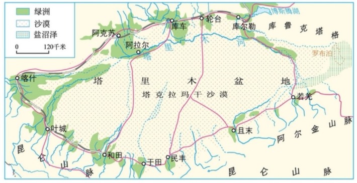
The Tarim Basin is located in southern Xinjiang, China, and is the largest inland basin in China. It lies between the Tianshan Mountains, the Kunlun Mountains, and the Altay Mountains, stretching 1,500 kilometers from east to west and about 600 kilometers from north to south, covering an area of 530,000 square kilometers. The basin’s topography slopes upward from west to east, with the famous Taklamakan Desert in its central region and Lop Nur, the “dry center” of Asia, in its eastern part. The edges of the basin are characterized by foothills, gobi deserts, and oases (alluvial plains). The Tarim Basin is a large, closed intermontane basin; geologically, it is a stable block surrounded by numerous deep, major faults. The basin’s topography is higher in the west and lower in the east, with a gentle dip toward the north.
Photos
More attractions in Ili
All attractions in Ili · Local guides in Ili
Frequently asked questions
How do I visit Tarim Scenic Area with a local guide?
Open the Ili page on MeetPanda, choose a local guide, and send your date. The guide buys tickets, plans the order with nearby sights and explains what you are seeing.