Qinghai Guide National Geopark
Qinghai Guide National Geopark is a scenic area in Xining, China.
Visitor information
- Also known as
- 青海贵德国家地质公园
- City
- Xining
- Coordinates
- 36.1404559, 101.579995
About Qinghai Guide National Geopark
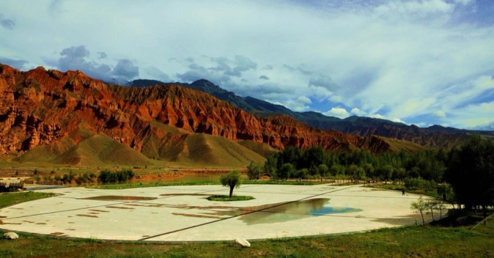
Qinghai Guide National Geopark is located in Guide County, Hainan Tibetan Autonomous Prefecture, Qinghai Province. In August 2009, it was approved by the Ministry of Land and Resources to become the fifth batch of national geoparks, with a total area of 554 square kilometers and a core geological heritage area of 113.6 square kilometers. The park uses sandstone peak cluster landforms, Yellow River Valley landscape and wind erosion landforms as its main geological relics, and consists of three main parks: Ashgong Park, Yellow River Valley Park and Mayu Gorge Park. The Ashgong Peak Cluster in the park is composed of the Miocene Xianshuihe Formation and the Pliocene Guide Formation, forming a colorful peak cluster landform; Mawu Gorge develops wind-eroded niches of various shapes, and the lithology is red brown, brown yellow and gray sandy conglomerate.
Photos
More attractions in Xining
- Ta'er (Kumbum) Monastery — 5A
- Ta’er Temple Scenic Area,Xining 13 — 5A
- Xining Sports Park — 4A
- Qinghai Provincial Museum — 4A
- Qinghai Tibetan Medicine Culture Museum (Qinghai Tibetan Culture Museum) — 4A
- Laoye Mountain Tourism Area — 4A
- Dan'ga'er Ancient City — 4A
- Xining Qinghai-Tibet Plateau Wildlife Zoo — 4A
All attractions in Xining · Local guides in Xining
Frequently asked questions
How do I visit Qinghai Guide National Geopark with a local guide?
Open the Xining page on MeetPanda, choose a local guide, and send your date. The guide buys tickets, plans the order with nearby sights and explains what you are seeing.