The first bay of Nujiang River
The first bay of Nujiang River is a scenic area in Shangri-La, China.
Visitor information
- Also known as
- 怒江第一湾
- City
- Shangri-La
- Coordinates
- 28.004446, 98.6352736
About The first bay of Nujiang River
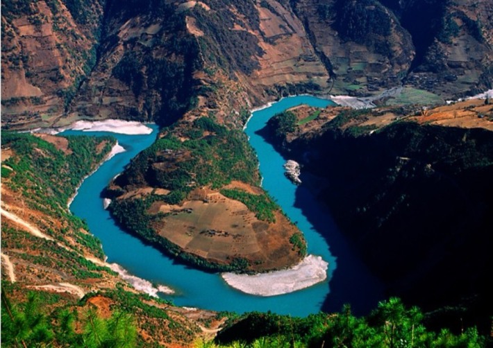
The First Bend of the Nujiang River is located near Ridan Village, Bingzhongluo Township, Gongshan County, Yunnan Province. It is an alpine canyon landform. The Nu River flows through here and is blocked by the Wangqing hanging rock and the Danla steep slope, forming a horseshoe-shaped bend of approximately 180 degrees. The river surface is 1,710 meters above sea level. The river turns from north to south to east to west and then flows eastward, forming the Kantong Peninsula surrounded by water on three sides. The platform is 500 meters higher than the Nu River. The river surface here is wide and gentle, and there are terraced fields and peach groves around it. It is known as the best photography spot in the Baili Nujiang Grand Canyon. The terrain in this area is steep, with upright cliffs on both sides of Shimen Pass, making it accessible only when the water level drops.
Photos
More attractions in Shangri-La
All attractions in Shangri-La · Local guides in Shangri-La
Frequently asked questions
How do I visit The first bay of Nujiang River with a local guide?
Open the Shangri-La page on MeetPanda, choose a local guide, and send your date. The guide buys tickets, plans the order with nearby sights and explains what you are seeing.